Understand what’s around you
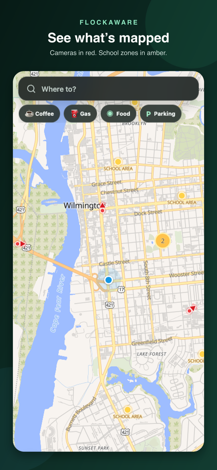
Flock and ALPR appear in red, schools and zones in amber, and expanded Pro surveillance in purple.
 App screenshot · static preview
Explore mapped Flock and ALPR cameras for free. Compare routes and navigate with spoken guidance—no account required. Pro and Offline Maps are optional upgrades.
Join now. Google Play test access is awaiting approval. Use the same Google account you use for Google Play.
Explore the map preview →Search any U.S. city, address, or destination. Red dots indicate mapped cameras; amber dots indicate mapped school zones and official school locations where drivers should verify posted restrictions.
Loading the interactive map…
FlockAware keeps the map, route comparison, and active guidance in one private, account-free experience.
Flock and ALPR appear in red, schools and zones in amber, and expanded Pro surveillance in purple.
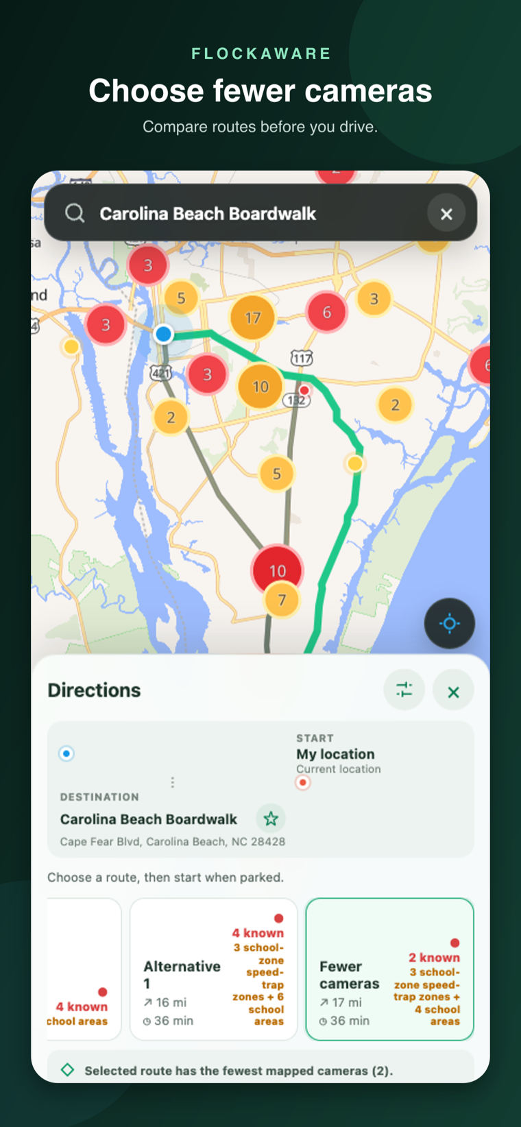
See the mapped exposure on each route and choose the option that fits your drive.
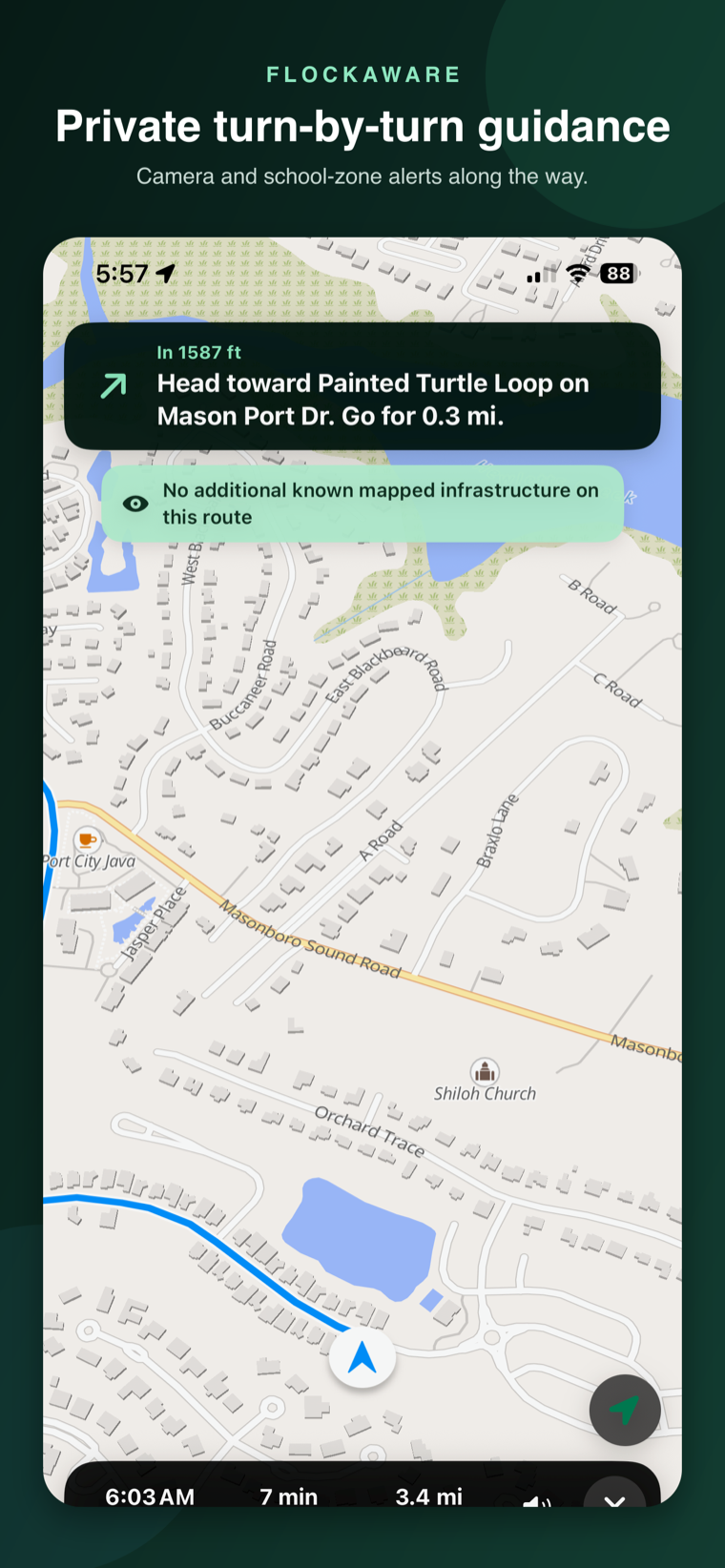
Follow turn-by-turn guidance with voice alerts and CarPlay while mapped infrastructure stays visible.
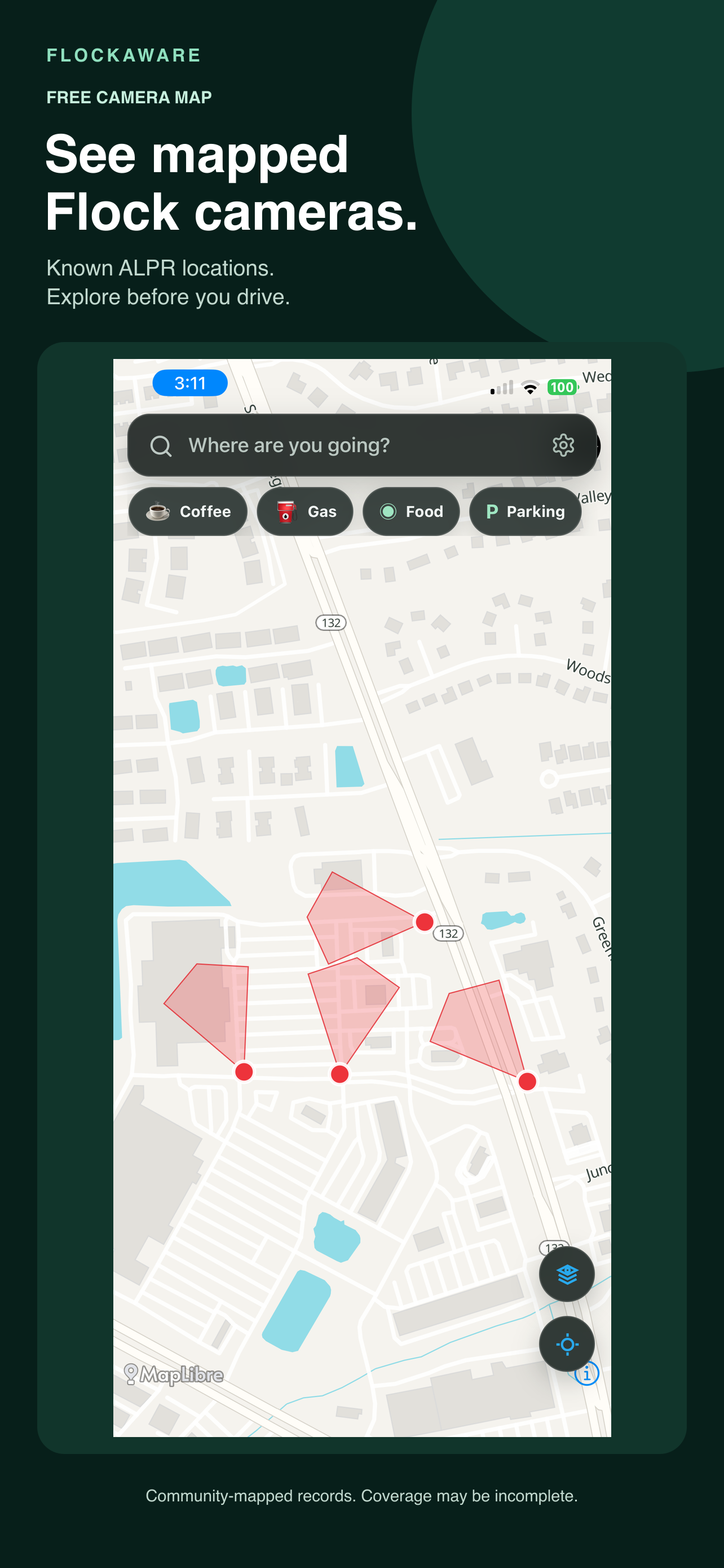
Explore publicly and community-mapped automatic license-plate reader locations across the United States.
See known school locations, explicitly mapped school zones, and school-related enforcement before you drive.
Pro adds available community-mapped CCTV and red-light, speed, and other enforcement-camera records.
See available publicly mapped acoustic-sensor records, clearly distinguished from visual cameras.
Compare time, distance, and known mapped infrastructure before choosing a route.
Follow turn-by-turn guidance and see directional cones where a source includes a mapped bearing or field of view.
Free basic camera maps and navigation on iPhone. Pro and Offline Maps are optional. Android users can join the tester group now.
Join now. Google Play test access is awaiting approval. Use the same Google account you use for Google Play; joining does not yet let you install the app. No purchase, rating, or review required.
FlockAware does not require an account, include advertising SDKs, or retain a server-side history of your searches, routes, or location. Saved destinations stay on your device.
Read the privacy policy →Nationwide ALPR and school awareness, search, route comparison, turn-by-turn navigation, CarPlay, and default voice alerts.
Adds available community-mapped CCTV, speed-enforcement, gunshot-sensor, and other surveillance records, plus 100 private saved places, watch areas, and custom driving alerts. Watch up to 10 saved places within a 1, 3, or 5-mile radius. Map changes are checked when you open the app online, up to once daily.
See how Pro watch areas work →Download supported U.S. city and state regions for offline place search, route planning, rerouting, and voice guidance. Pro features are included while subscribed. Download complete coverage before going offline; live traffic and live map updates need a connection.
See how offline navigation works →FlockAware shows known, community-mapped Flock and automatic license-plate reader (ALPR) locations. It does not scan for nearby hardware or access license-plate data. A missing marker does not mean a road has no cameras.
Search your city or address in the live map above, or explore nearby mapped cameras in the iPhone app. Open a record to inspect available source details. Coverage depends on community mapping.
Yes, with Offline Maps and a complete downloaded region. Search downloaded places and use turn-by-turn navigation inside its coverage. This does not make a connected phone invisible to cellular networks.
See mapped records added, changed, or removed near saved places. Checks run when you open the app online, up to once daily—not continuously in the background. Map edits do not confirm physical equipment installations or removals.
Core navigation stays useful without ads or selling personal data. Optional website donations help cover maps, routing, and national dataset delivery.
FlockAware displays known community-mapped locations derived from OpenStreetMap. Records may be incomplete, outdated, or imprecise and should never replace posted road signs or attentive driving.
FlockAware is an independent navigation and public-map awareness app. It is not affiliated with, endorsed by, or sponsored by Flock Safety.